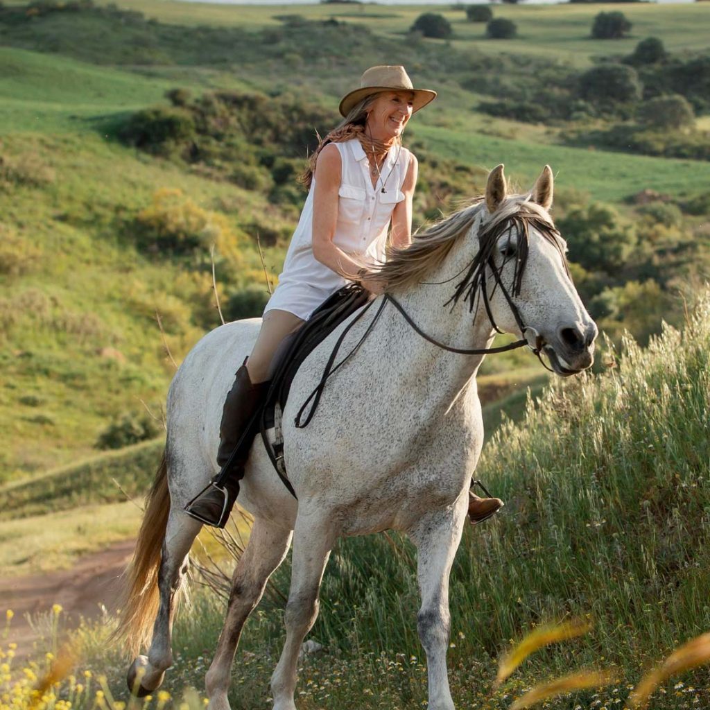
Impossible to get bored in Escorca
ADVENTURE AND SPORTS
Practice adventure and sport
The municipality of Escorca is located in the heart of the Serra de Tramuntana, declared a Natural Site in 2007 and a World Heritage Site in 2011. The peaks, streams and valleys of Escorca are the perfect setting for the practice of numerous sports of nature, such as mountain biking, climbing, descending torrents or caving.
When developing these activities, you must always take into account the nature of the space where they are practiced. The Serra de Tramuntana Natural Park was created to conserve exceptional natural and cultural values that must be protected and respected. Many of these activities are regulated and, in some cases, prior authorization is necessary from the body managing the natural spaces of the Balearic Islands, currently the Balearic Institute of Nature (IBANAT). On the IBANAT website, you can consult the authorized activities in protected natural areas and how to request these authorizations.
It should also be remembered that a very high percentage of accidents that happen in the mountains are due to human errors that can almost always be avoided. For this reason, it is advisable to always take extreme precautions and follow the recommendations to prevent accidents or mitigate them from the Mountain Service of the Civil Guard.

Safety comes first
- Before you go out, check the weather forecast. Don't go out in bad weather.
- Let us know where you are going and when you plan to return.
- Bring suitable clothing and equipment, water and sufficient energy food.
- Never go alone and plan the activity properly.
- Stay off the path or footpath and follow the traditional signs.
- Consider your physical conditions and reserve strength for the lap.
HIKING
Escorca hiking trails
- Ascent to Puig de Massanella
At kilometer 14.8 of the Caimari-Lluc road, just before the Coll de Sa Batalla, we will find an indicator with a map of the area. The wide track leads to the barrier of the Comafreda estate, where we will have to pay the entrance fee. Consult the rates on the Puig de Massanella website. Once at the Coll de Mancor or Sa Línia, we will find two large stone pylons placed years ago by the Mallorca Tourism Promotion that indicate the three possible directions: towards Mancor, towards Lluc and towards the summit of Massanella. Very close is the first of the massif’s snow deposits: the Casa de Neu Major, which is the one located at a lower altitude; the other two are already in Pla de Sa Neu, near the summit. From the Coll de Sa Línia starts the trail that leads to the summit. This is the old road used by the snowmen. We will have to carefully follow the path that will take us to Pla de Sa Neu and from there to the top of Puig. We will still find another stone pylon that indicates two alternative climbs to the top: the one on the right is the most direct, following the old path, while the one on the left goes by the Font de s’Avenc.
– Degree of difficulty: High
– Total duration: 5 hours without stops
– Access: You can get there by bus from Palma. With your own vehicle, you must follow the Ma-13 highway to Inca and from there the Ma-2130 road to the Es Guix urbanization
– Starting point: Urbanization Es Guix
– Circular route: Yes
– Signposted route: No
– Recommended time: All year
- Ascensal Puig de l'Ofre
Following the directions of the GR-221, we will arrive without difficulty at the Coll de l’Ofre, from where the views of Pla de Cúber and Puig Major de Son Torrella are spectacular.
Once at the pass, we will leave the signposted path and turn left, entering the forest. We will soon reach a comfortable dirt track that will take us to Coll dels Cards, between Na Franquesa, on the left, and l’Ofre, on the right. The climb from the Coll dels Cards is more rocky and a bit difficult. Don’t forget to look at the sky from time to time, because vultures often fly over these peaks.
From the Coll de Sa Línia starts the trail that leads to the summit. This is the old road used by the snowmen. We will have to carefully follow the path that will take us to Pla de Sa Neu and from there to the summit of Puig. We will still find another stone pylon that indicates two alternative climbs to the summit: the one on the right is the most direct following the old path, while the one on the left goes through the Font de s’Avenc.
– Degree of difficulty: Medium
– Total duration: 3 hours without stops
– Access: You can get there by bus from Lluc (only from April to October, to be confirmed on the Mallorca Transport Consortium website). With your own vehicle, follow the Ma-10 road from Lluc towards Sóller until kilometer 34
– Starting point: Entrance of the Cúber public estate
– Circular route: Yes
– Signposted route: Only up to the Coll de l’Ofre
– Recommended time: All year
- Back to the Cúber reservoir
Very simple itinerary, suitable for families. It links with the section of the Ruta de Pedra en Sec that descends towards the Sóller valley. Pla de Cúber is surrounded by the highest mountains of the Sierra, at the foot of Puig Major de Son Torrella. Formerly, it was occupied by some houses of possession and their cultivated lands and pastures; today, the waters of the reservoir that supplies the city of Palma, occupy it almost completely. Thanks to this body of fresh water available all year round, the Plan has become an ideal place for bird watching.
– Degree of difficulty: Low
– Total duration: 1 hour and 40 minutes without stops
– Access: You can get there by bus from Lluc (only from April to October, to be confirmed on the Mallorca Transport Consortium website). With your own vehicle, follow the Ma-10 road from Lluc towards Sóller until kilometer 34
– Starting point: Entrance of the Cúber public estate
– Circular route: Yes
– Signposted route: Yes
– Recommended time: All year
- Sa Costera
In the first part, the route runs along a dirt track that goes downhill, through olive groves. We will pass through the estates of Bàlitx d’Amunt, Bàlitx d’Enmig and Bàlitx d’Avall, the latter dedicated to agrotourism. From here, the path begins to climb until reaching the Coll de Biniamar, the highest point of the route. The descent from the pass will quickly take us to the seaside. Here it becomes a real viewpoint that meanders flat, clinging to the cliff. Halfway, a fork indicates the descent to the factory that supplied electricity to Sóller until 1962. Back on the main road, we will continue towards Cala Tuent. From Cala Tuent, there is the possibility of returning by boat to Port de Sóller. The company Barcos Azules offers a special Taxi Boat service that makes the crossing between Port de Sóller and Cala Tuent. You can also continue to Sa Calobra (it involves another hour of travel) and return by boat from there with Barcos Azules, which makes daily departures between Port de Sóller and Sa Calobra, or by bus to Escorca and Lluc (15:00 only from April to October and from Monday to Saturday, to be confirmed on the website of the Mallorca Transport Consortium).
– Degree of difficulty: Medium
– Total duration: 3 hours and 15 minutes without stops
– Access: You can get there by bus from Port de Sóller (every day from April to October at 9am, except Sundays). With your own vehicle, follow the Ma-10 road from Sóller towards Lluc, up to kilometer 44.8
– Starting point: Mirador de ses Barques
– Circular route: No
– Signposted route: Yes
– Recommended season: All year round
CYCLING IN THE SERRA DE TRAMUNTANA
Escorca cycling routes
- Cycling route Selva - Lluc
The road from Selva to Lluc offers a pleasant climb shaded by pines and oaks. Along the route, marked by continuous curves, you can enjoy spectacular views. The first curve after the center of Caimari provides a beautiful panorama of the houses of the village of Selva and its church. The climb concludes at the Coll de Sa Batalla, where cyclists usually stop to recover their strength. The route ends at the monastery of Lluc.
– Distance: 12.58 km
– Ascent: 428 m
– Descent: 114 m
– Initial elevation: 166 m
– Final elevation: 481 m
PURE ADRENALINE
Descent of torrents in Escorca
- Pareis torrent
This is one of the most emblematic and spectacular routes on the island. The descent of Torrent de Pareis is not easy and requires mountain experience. It is recommended not to do the route alone. There are sections with climbs and descents where the use of ropes may be necessary. It is strongly recommended to consult the weather forecast and not to do the route in case of rain forecast. The descent starts at the Escorca houses and runs along the bed of the stream, sometimes with large boulders. The final section of the route crosses the impressive Torrent de Pareis gorge, between vertical walls up to 300 meters high, before ending up in Sa Calobra.
– Degree of difficulty: Very high
– Total duration: 5 hours without stops
– Access: Own vehicle. Follow the Ma-10 road until kilometer 25.9
– Starting point: Casas d’Escorca
– Circular route: No
– Signposted route: No
– Recommended season: Spring and summer
- Mortitx torrent
This is a technical and spectacular route that requires experience in canyoning. The route crosses several rappels, so it is necessary to bring the right equipment and have knowledge of descent techniques. This ravine is especially attractive after heavy rains, when spectacular waterfalls form. The route ends at the sea, so it is recommended to check the sea conditions before making the descent. Access to the ravine is from the entrance to the Mortitx estate. The duration of the descent is relatively short, but requires technical skill.
– Degree of difficulty: High – Total duration: 1 hour and 30 minutes without stops – Access: Own vehicle. You must follow the Ma-10 road until kilometer 10 – Starting point: Mortitx estate entrance – Circular route: No – Signposted route: No – Recommended season: Spring and autumn
OTHER SPORTS IN ESCORCA
All you can practice
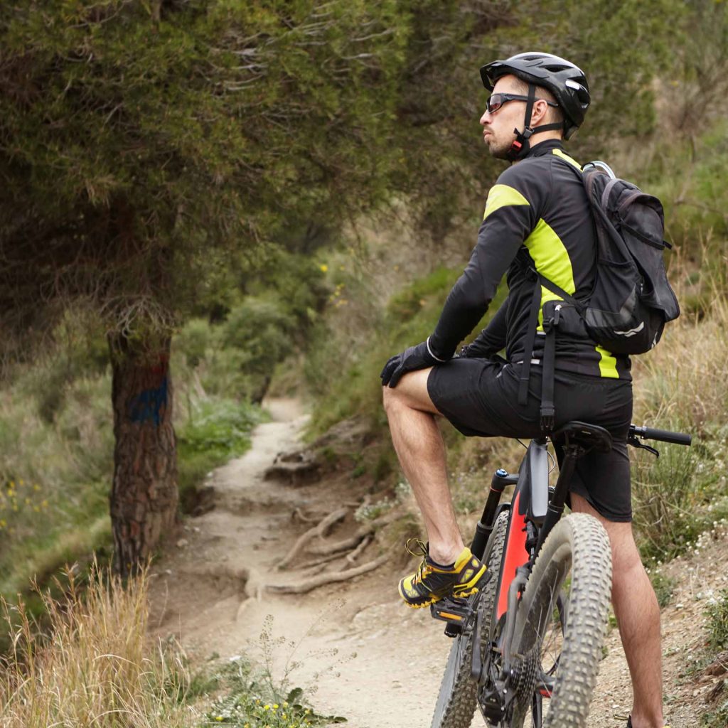
Mountain bike
The steep topography and the extensive network of Escorca paths make this municipality the perfect place for mountain biking. Although this activity is not regulated or signposted, it is recommended to always respect private property and keep the environment clean.
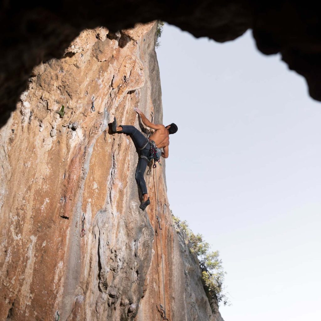
Climbing
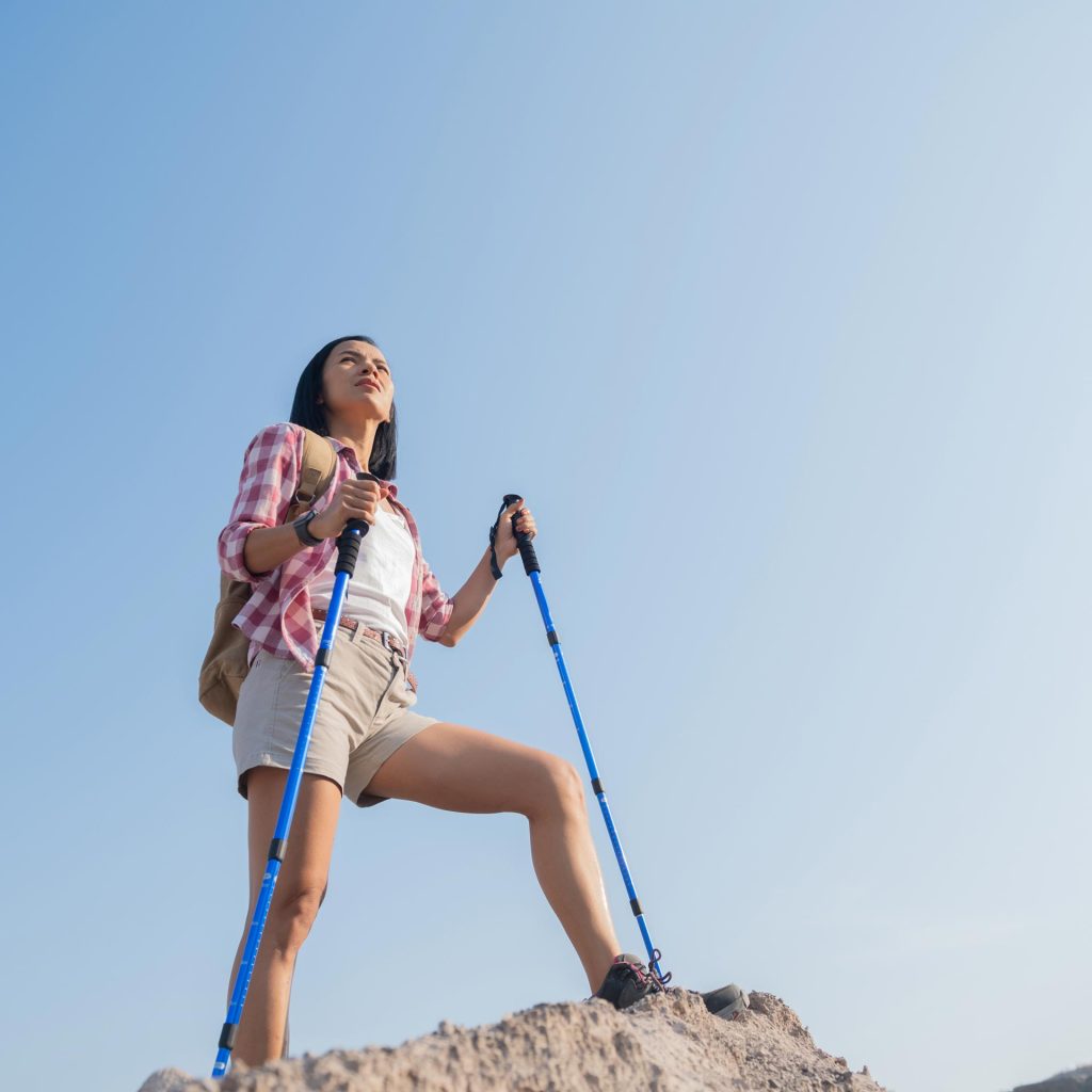
Nordic walking
Nordic walking can be practiced on any of the trails and paths in Escorca. This sport, originally from the Nordic countries, consists of walking with the help of poles similar to those used in skiing.
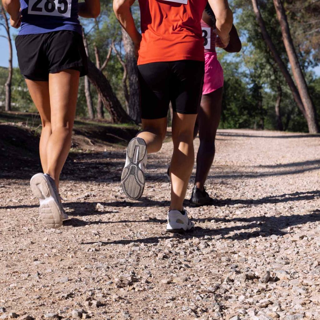
Races and marches
Escorca hosts several popular races and marches, such as the Barranc de Biniaraix race and the Travessa per Serra de Tramuntana.
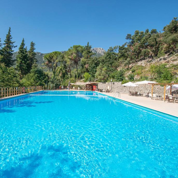
Sports grounds
In the Santuari de Lluc there is a semi-Olympic swimming pool that can be used with prior reservation.
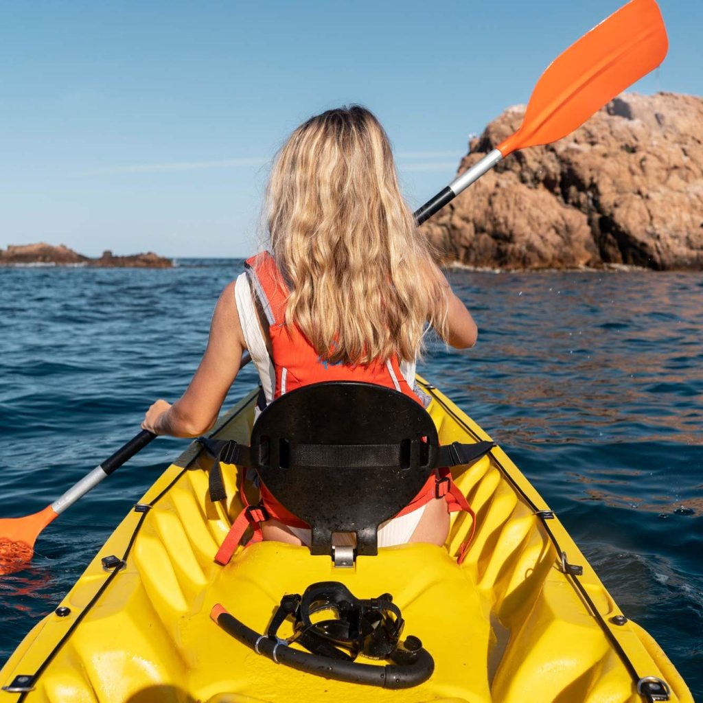
Kayaking
Access to the sea at Cala Tuent or Sa Calobra allows kayaking in calm and transparent waters.
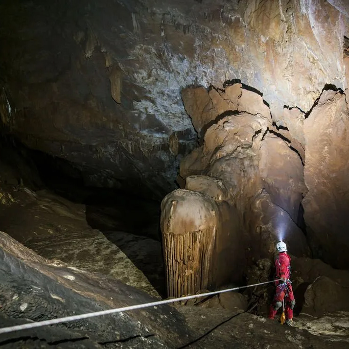
Speleology
Escorca has several cavities and caves that can be explored by speleology enthusiasts, as long as they have prior authorization.
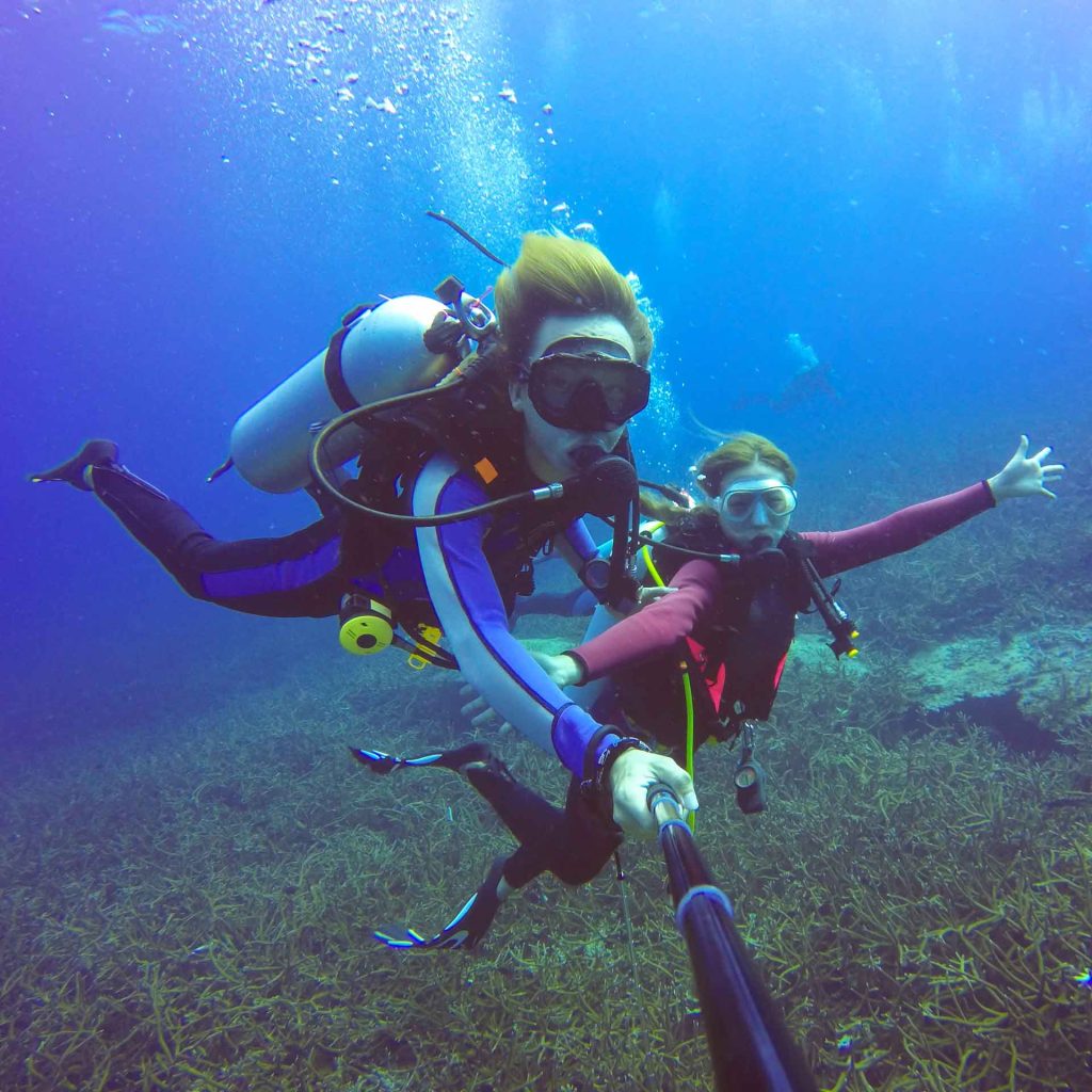
Diving
The transparent waters rich in biodiversity along the coast of Escorca are ideal for diving.